
Explore the world’s drone spots — directly from the map.
AirViewHub: The discovery & sharing community for aerial creators.
Search stunning drone locations across the globe on an interactive map.
And share your own drone videos with drone pilots from all over the world.
📍 Wondering where to fly next?
The answer is already on the map.
Curated collections of aerial videos, and the pilots who film them. See all collections →
Drone footage of the waterfalls selected as Nihon no Taki Hyakusen, Japan's official list of 100 famous waterfalls.
18 videos →First-person-view drone flights through waterfalls: every video tagged both FPV and Waterfall. Today nearly all of them are by Shizuenoko on the Kii Peninsula.
46 videos →Drone videos of UNESCO World Heritage sites around the world, from Angel Falls to Everest, pinned to the exact spot.
53 videos →Drone videos of fall foliage: gorges, temples and waterfalls wrapped in red and gold.
41 videos →The pilots who post their own footage, with their personal maps and pages.
6 pilots →A new page lists the YouTube channels that agreed to have their aerial videos featured on the map through AirViewHub's curation accounts.
Four themed collections and a page introducing the pilots who post their own footage, with their personal maps.
Every pilot who posts gets a personal map and a page with all their videos. Here is where the links are.
Built for drone pilots who want to discover, learn, and connect.
Search by theme — World Heritage, Waterfalls, Castles, Coastlines, Mountains, Islands, Night Views, and more.
See actual drone shots showing terrain, scenery, compositions, and visibility.
Upload your videos and they become pins on the world map — a permanent record of where you’ve flown.
Favorites, viewing history, and MyMap gallery become available once you sign up.
Click a pin to watch aerial videos of that location instantly.
AirViewHub Map
Complete search functions to match your mood and setting, such as “World Heritage” 🌍, “Waterfall” 💦, “Castle” 🏰, and more. Find your next spot based on what you want to shoot.
AirViewHub Map
Your uploads become a shareable map-style portfolio.
AirViewHub Mypage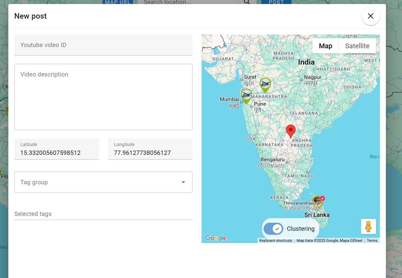
Save places you want to visit later and revisit videos easily.
AirViewHub Map
Altitude × trajectory × speed — displayed automatically.
DJI SRT file viewer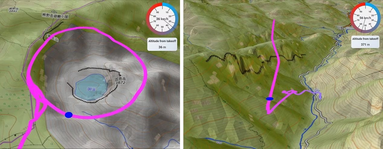
Your aerial shots enrich the world map.
When you upload:
Thousands of pilots discover their next destination through others’ videos.
The next upload that inspires someone may be yours.
Drag & drop your SRT file — your flight path appears in 3D instantly.
AirViewHub is a place where drone pilots truly connect.
Flying alone is fun.
But sharing the experience takes it further.
Your flights could be the next to inspire others.
AirViewHub is 100% free to use.
Whether you fly for hobby, travel, business, filmmaking, or competition — you’re welcome here.
Share the joy of flying with creators around the world.
Explore the World from the Skies with AirViewHub 🌍✈️